Depending on where you do the majority of your boating, you’ll likely become familiar with the local wake zones positioned within your waterways. “No wake zones” are the most common areas boaters will come across, but there are other types of regulatory zones that you should be aware of, including:
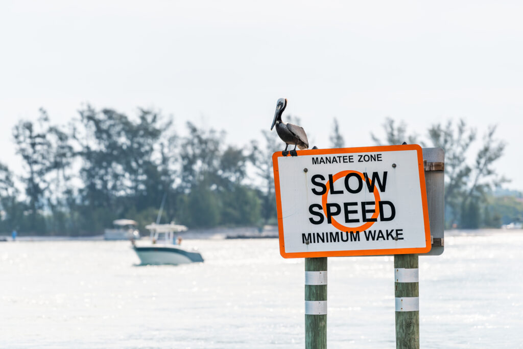
- Slow Speed, Minimum Wake: areas where vessels must be fully off plane and completely settled in the water, putting off a very small wake.
- Maximum 25 MPH, 30 MPH, and 35 MPH Speed Zones: areas where vessels are prohibited from exceeding the posted speed limit.
- Vessel Exclusion Area: areas where all vessels, or certain types of vessels, are prohibited from entering a controlled area (sometimes these signal swimming locations or protected wildlife habitats). These wake zones are signed with a vertical diamond shape with a cross in the center.
Regardless of whether you do most of your boating in freshwater or saltwater, understanding posted wake zones and the rules that go along with each zone is an important ability for boaters of all experience levels.
What is a No Wake Zone?
Although the most common, no wake zones, also called “idle speed zones,” can still be confusing for many boaters—particularly new boaters. No wake zones are typically positioned close by to marinas, inlets, bridges and underpasses, canal entries, and residential areas close to shore with private docks.
A no wake zone designates an area where vessels must be operated at the very minimum idle speed in order to maintain forward motion and steerage. While in a no wake zone, all vessels should not produce a wake.
Identifying Wake Zones Using the KnowWake App
One of the many useful tools within the KnowWake app is our Wake Zone identifier. Much like its name describes, this feature is an easy-to-use, color-coded system that helps boaters understand the different rules and regulations of wake zones that you may come across while you’re out on the water. The biggest difference between one wake zone and another is typically the speed limit.
Looking at your chart, wake zones will appear in one of four colors: either red, yellow, orange or green.
- Red = Idle: Lowest speed to maintain steerage and forward motion. Speed: 2-3 MPH/3-5 KM/H.
- Yellow = Slow: Little or no wake. Vessel must be completely settled in the water. Speed: 5-7 MPH/8-11 KM/H.
- Orange = Tow: Allows vessels towing passengers the right of way and other high-speed activities.
- Green = Normal: Resume normal safe speed according to current water traffic conditions.
Additional Tips for Navigating Wake Zones
While using the KnowWake app is the easiest way to be continuously aware of what kind of wake zone your boat is currently navigating, there are a few other tips to keep in mind:
- Always slow down in advance before crossing into any regulatory wake zone.
- Be sure to trim your engine to a vertical position to ensure you produce the smallest wake.
- Always be aware of your surroundings and pay attention to posted navigational signs.
- Even if there is no signage signaling a wake zone, whenever you’re within 500 feet of shore you should always slow down.
Ready to try the Wake Zone Identifier on your next boat outing?
Download the KnowWake app today.