Boaters, sailors, and cruisers who frequent the waterways around Fort Myers Beach, FL, including the Caloosahatchee River and the Okeechobee Waterway, are very familiar with what’s come to be known as the “miserable mile.” The miserable mile is a stretch of channel with a strictly enforced “no wake” zone that is responsible for connecting the Caloosahatchee River to the Gulf Intracoastal Waterway, and Matanzas Pass into Ft. Myers Beach.
So, just how did the miserable mile get its infamous nickname? Let’s dig in to find out, as we review three things all boaters should know before navigating the waters of the miserable mile.
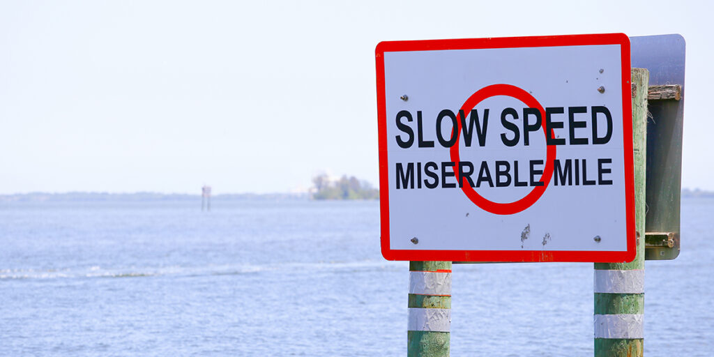
The Miserable Mile
1. No Wake Zones are Strictly Enforced
Many speculate that the miserable mile got it’s tagline due to “miserable” power boaters frequenting the area, forced to slow down and adhere to all the posted boating regulatory zones—instead of zipping through the channel on plane.
The area is also known to be an active manatee zone, with signs clearly marked, “Manatee Zone, Slow Speed, Minimum Wake.” It’s common to see multiple boats pulled over at once, with local law-enforcement and the Florida Marine Patrol on high alert.
2. Stay within the Narrow Channel, or Risk Running Aground
Other locals rumor that the miserable mile got its name long before the area was designated as a slow zone. Why? Well, sailboats, for example, don’t usually mind navigating this area because it’s known to have strong cross currents, which can help them steer through this narrow channel. However, all boaters and sailors should be warned, the channel is so narrow that straying outside of the markers even just a foot could risk hitting bottom and running aground.
3. Keep an Eye on the Tide and Currents
Already known as an area with very shallow waters, understanding the tidal currents presents yet another challenge for boaters cruising the miserable mile. Be aware of low tide and have a tide chart on hand. When the tide is flowing across the channel, navigation can be extra miserable, particularly for slower boats.
Boating around Fort Myers & Sanibel Island
With strong tides, slow speeds, and at times, high traffic, it’s easy to see why this area of waterway is often described as “miserable.” Nevertheless, this coastal region around Sanibel Island and Fort Myers Beach is a popular hub for boating and cruising. Once you’re confident navigating the miserable mile, be sure to explore these locations for great fishing, on-water fun, and dock-and-dine opportunities:
- Blind Pass
- 10,000 Islands
- Cape Harbour
- Fort Myers Yacht Basin
- Lover’s Key State Park
For help navigating the miserable mile and all the popular boating hot spots in and around Fort Myers, FL, be sure to download the KnowWake app today.